Real-time clarity for critical emergency operations
Enhance situational awareness, expedite decision-making processes, and optimize resource allocation, reducing the impact of emergencies on affected populations
Integrate, Collaborate, and Respond: Enhancing Situational Awareness
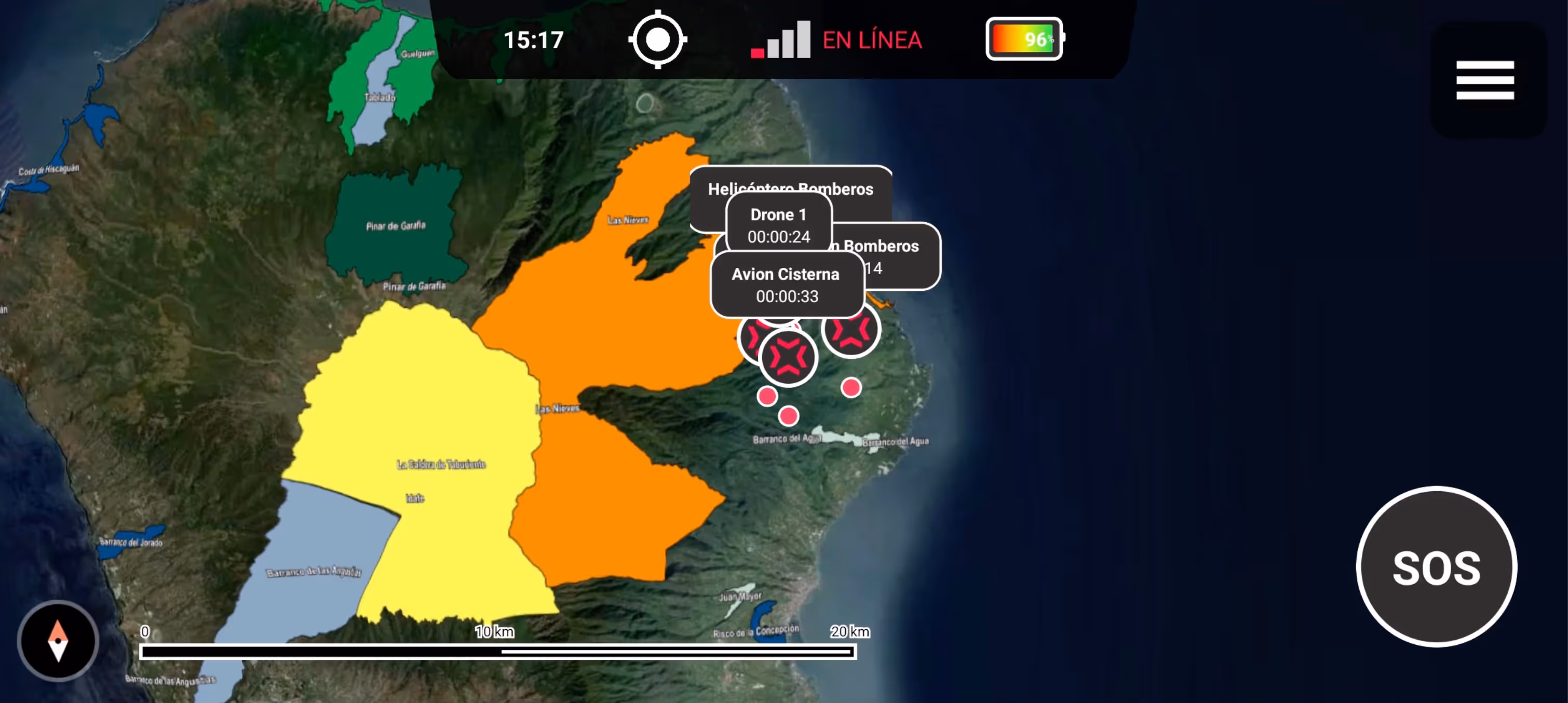
Gain full operational visibility across agencies, teams, and territories.
Enable deployed teams to report, receive tasks, and navigate offline. Keep command centers in sync with frontline units.
Ensure safe, efficient deployment of all critical resources.
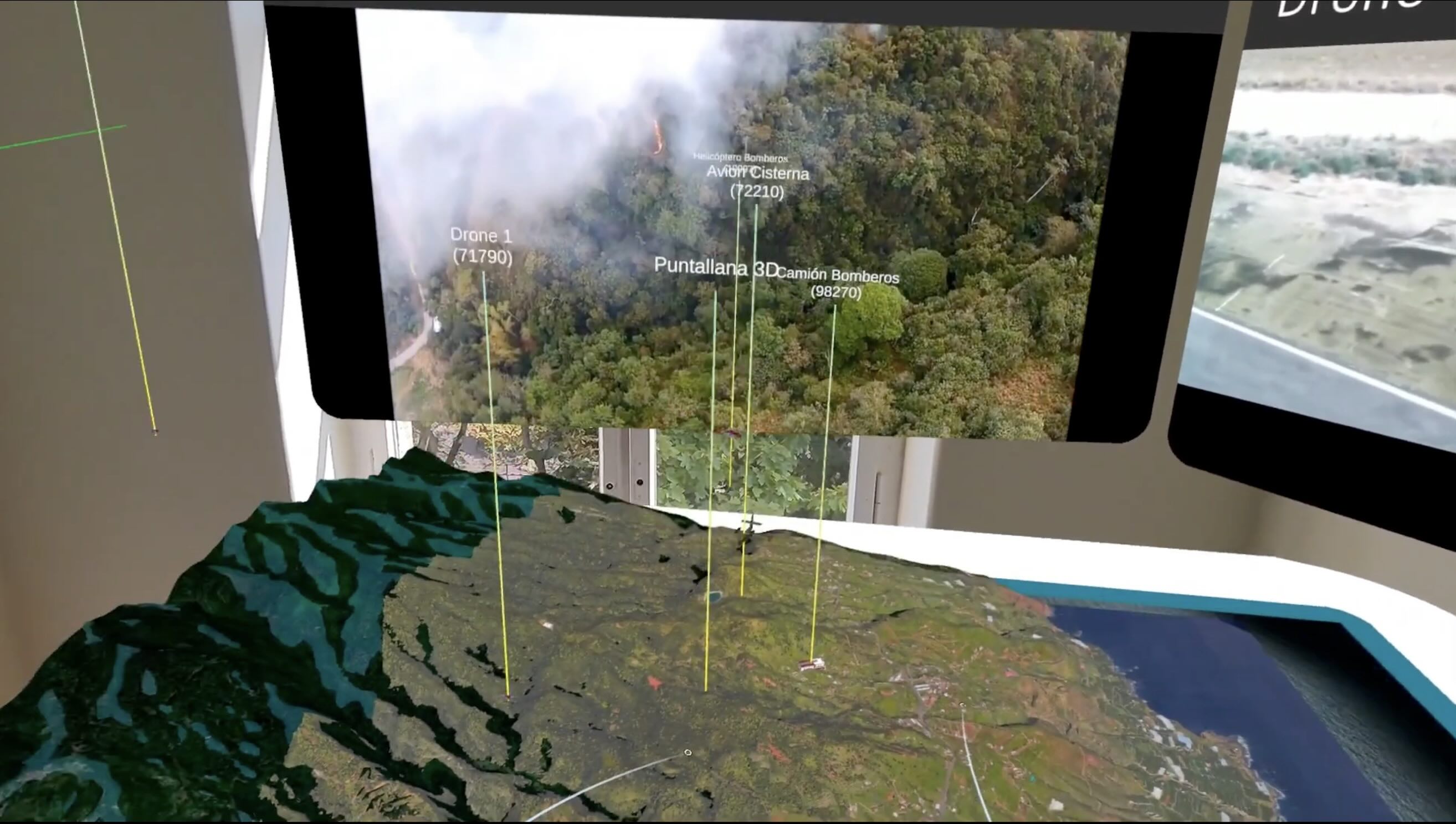
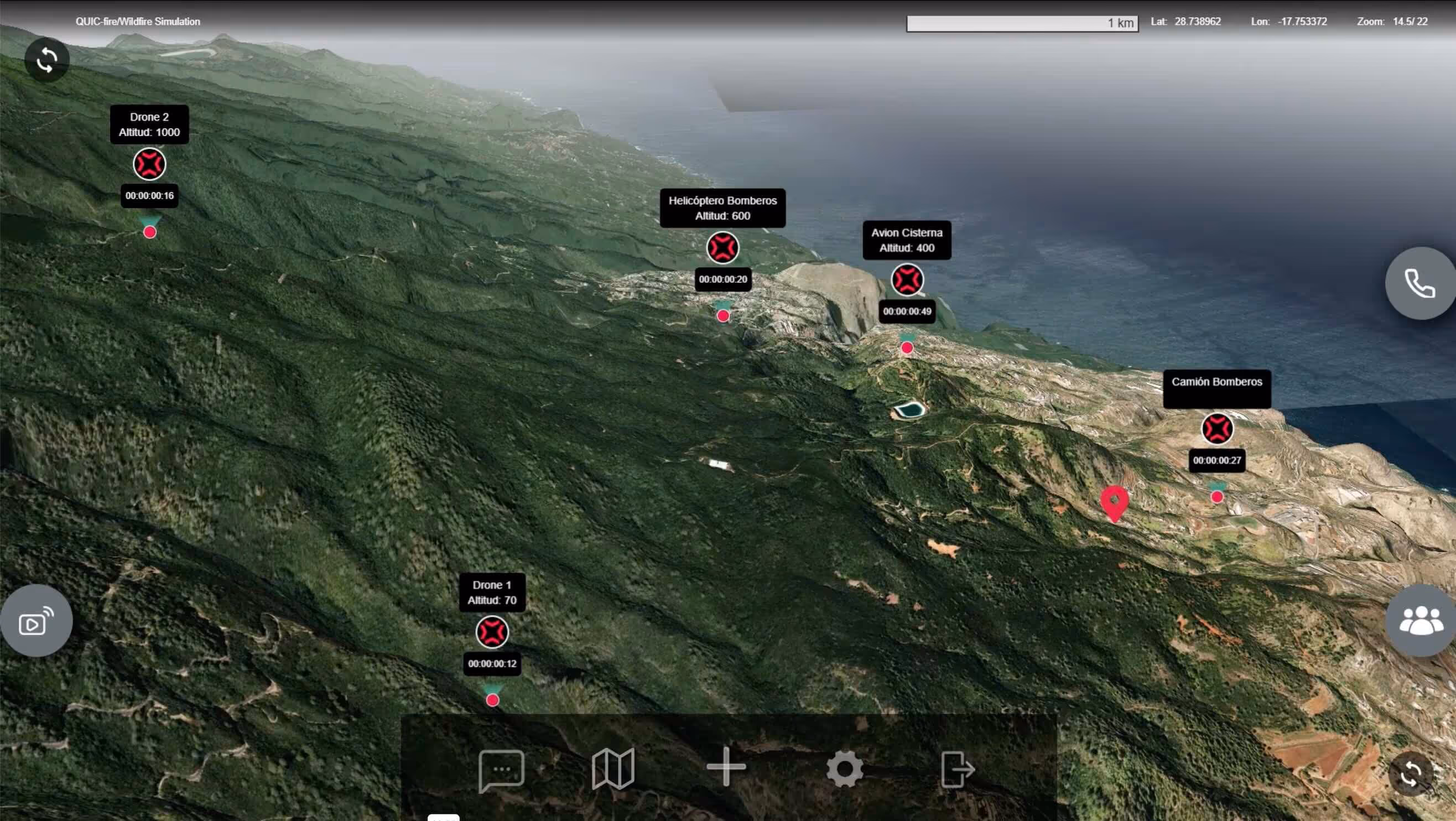
Consolidates data from multiple sources into a single interface in 3D with geospatial and sensor data combined.
Simulation and training

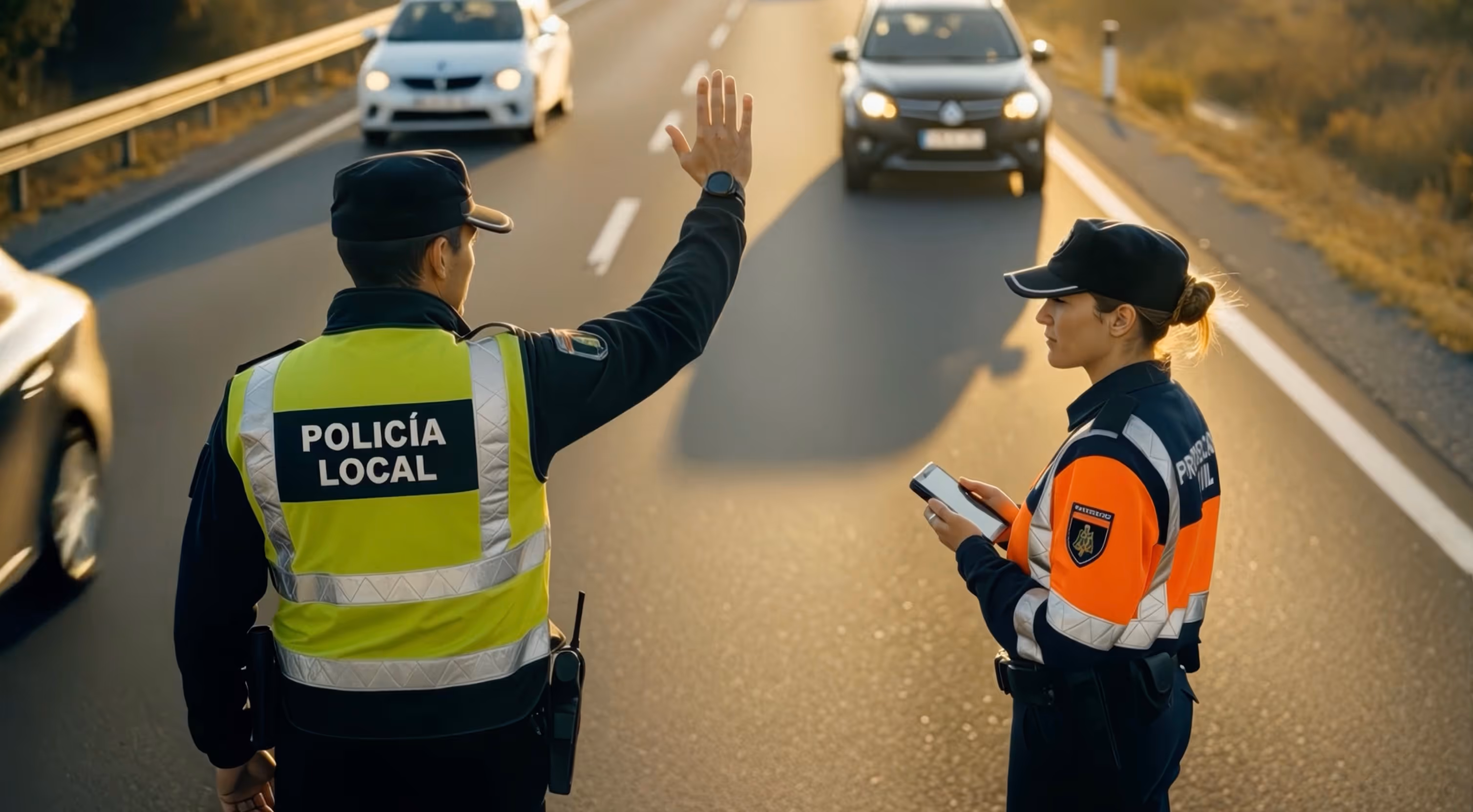
Cross agency coordination
Key Features and main capabilities
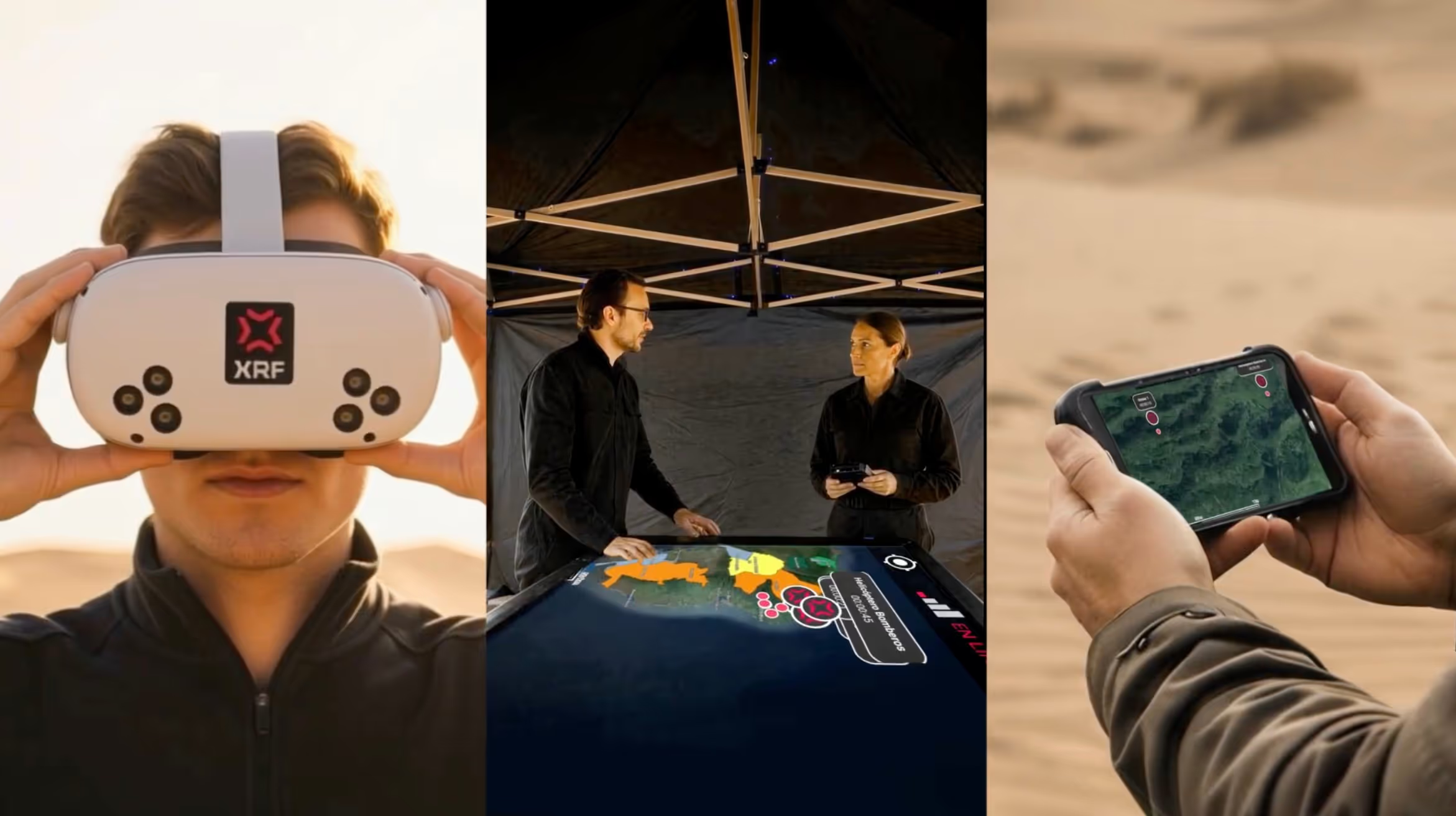
Simulate real-world emergency scenarios using XR and AI technologies, improving preparedness and response efficiency.
The adaptable nature of the platform allows users to access it on various devices, including VR, AR, PCs, tablets, and smartphones, making it versatile in different emergency settings.
3D representation of terrain and assets in real-time, with GIS layer integration, route mapping, and tactical tracking.
Helping those who make the world a better place
Get a walkthrough of our C3 ecosystem